The Map Display, Tracking DUAL ROV Locators
When connected to an ROV Locator Receiver set to track two ROVL transmitters, the CeruleanMap display will show a second ROV icon. The main ROV icon is a diamond shape and will be either red or yellow depending on which output you have selected in CeruleanTracker. The secondary icon is a violet square.
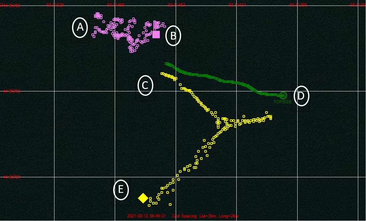
Example Map showing dual ROVL transmitter position. A buoy with a transmitter was dropped at point (A). It drifted to point (B), and the current position is the violet square icon. The ROV was launched near point (C) and was driven to point (E) along the yellow trail. The primary ROV (E) is attached to Blue ROV. Meanwhile, the Topside GPS (green circle and trail) attached to the boat drifted to point (D).