During a bathymetry survey at the coastal waters of Madura island, East Java, Indonesia we found a shipwreck the size of ~ 40 x 8 meters. Our BlueBoat was equipped with Cerulean’s Surveyor 240 Multibeam Echo-sounder and two Omniscan 450 Side Scan Sonars. The location of the shipwreck is about 240 meters from the shoreline where our base were at.

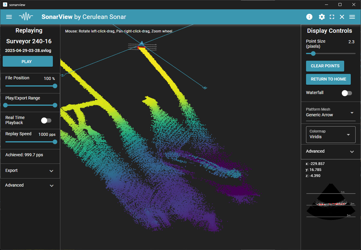
We spotted the shipwreck shape at the end of our first survey day (29th of May 2025) when we were reviewing the SVLOG files of Surveyor 240 MBES, with SonarView.
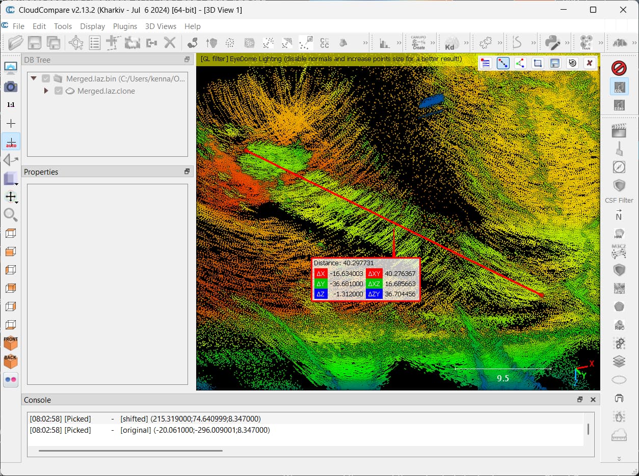
We measured the size of the indicated shipwreck using Cloud Compare to open and analyze the CSV Point Cloud. And also marked the location of the indicated shipwreck using ReefMaster after processing the combined CSV file.
On the second survey day (May 1st, 2025), after we finished our continuation of survey using the Surveyor 240, we drove the BlueBoat to the location of the shipwreck and started to use the attached twin Omniscan 450 SS to get ‘a picture’ of it… and we were able to confirm that it is a shipwreck. We drove back and forth the shipwreck location to get a good enough picture…

The Bathymetry map on the beginning of this writing was produced with Reefmaster combining data from two surveys: (1) from May 2025 when we found the Shipwreck using Surveyor 240 MBES and (2) from May 2024 using Ping2 SBES up to ~200 meters from shoreline. We were able to go further this time (370 meters from the shoreline) because we upgraded the BlueBoat to have 4G connection (+ Zerotier).
As for the finding of the shipwreck, we could not have spotted the shape unless it is with a Multibeam Echo Sounder. We were lucky more than thrice, with the MBES, with finding the shipwreck, with the Side Scan Sonar… and the 4G on the BlueBoat…